A Road Trip Guide to the Denali Highway
Updated August 2022 | Originally published August 2022
Posts on Alaska on a Bootstring likely contain affiliate links. If you click, book, or buy from one of these links, I may earn a commission. Read more in my Privacy Policy.
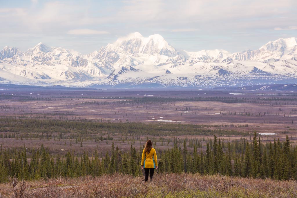
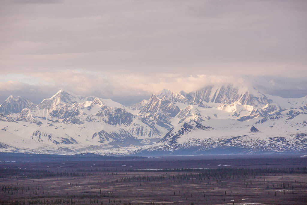
Cutting across Alaska’s interior connecting the towns of Paxson and Cantwell, the Denali Highway is one of the 49th State’s best road trips. Highlights of the Denali Highway of course are the epic mountain views of both the Alaska Range and the Wrangell St. Elias Range.
The Denali Highway is only maintained from May to October each year, making it impassible by car through much of the winter due to snow levels once the interior gets snowed in for the year.
It is also important to note that the Denali Highway is not the same road as the Denali National Park Road. The Denali Highway does not enter the national park.
Denali Highway History
Also known as Alaska Route 8, the Denali Highway officially opened in 1957 giving access to Denali National Park from the Glenn Highway. Most people these days would access Denali National Park from the Parks Highway, which wasn’t built until 1971.
The Best Time of Year to Drive the Denali Highway
The best months to take on a road trip down the Denali Highway is from mid-June through mid-September. Of course, the road is maintained from May to October but at the beginning and end of that time, the roads can be impassible at times if the weather is bad.
To see road conditions check out the Alaska 511 website or you can call them by dialing 511 if you are in Alaska or 866-282-7577 if you are outside of Alaska.
Rental Cars & Vehicles on the Denali Highway
At 134 miles in length, the Denali Highway is an almost entirely dirt road with just a small section of it being paved on both ends. This is an important fact to note as many rental car companies will not allow their vehicles to be driven off of paved roads.
Before taking on the Denali Highway it would be wise to check and see if your rental contract will allow for it. In this case, I would recommend Alaska 4×4 Rentals as they do allow their cars on dirt roads.
How Bad of Conditions is the Denali Highway in?
This can differ from year to year as the Denali Highway is somewhat remote and maintenance is hit and miss. If you happen to travel the Denali Highway on a year where it has been recently worked on then chances are the road can be in decent condition.
You’ll likely find that there are sections of the road that are smooth sailing and other sections where it is rutted out and littered with potholes. You’ll want to drive carefully to avoid any damage to your car.
Tips & Important Info for Driving the Denali Highway
- Bring at least one spare tire with you. It’s not unheard of to get flats along the route owing to sections in poor conditions.
- Make sure and either fill up with gas in Glennallen or Cantwell depending on the direction you take.
- There are few services along the highway. The Maclaren Lodge offers limited services including vehicle repair and has a restaurant.
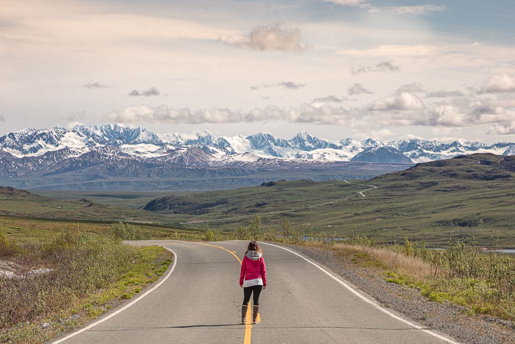
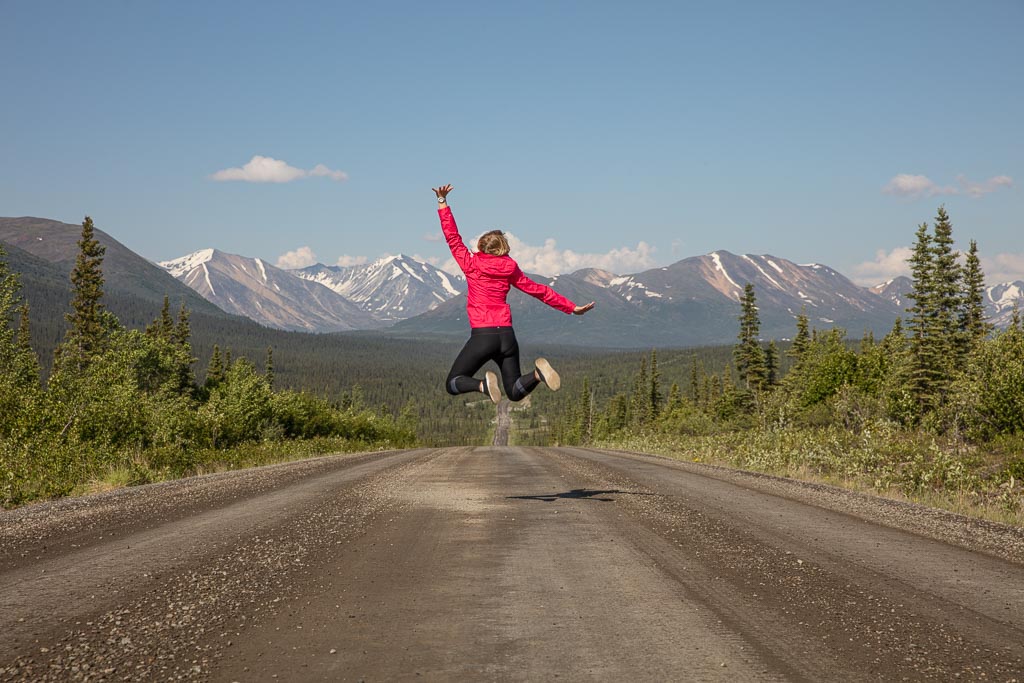
- The Denali Highway is only paved on the first 21 miles in from Paxson and the first 3 miles in from Cantwell, otherwise, it’s entirely dirt.
- You can camp pretty much anywhere along the Denali Highway unless it’s private property. There are heaps of pull-offs along the route perfect for camping.
- There are also two maintained BLM campgrounds along the way.
- There are 5 lodges along the Denali Highway for those that don’t want to camp.
- You can drive the entire route in a single day if you are pressed for time, but it’s best to allot at least one overnight, if not more.
- Driving the Denali Highway in either direction will give epic views, but most opt to drive it from Paxson to Cantwell.
- Yes, it is possible to see the northern lights along the Denali Highway in early May, late August, and September if you get lucky.
- You can travel along the route in the winter months after the highway is snowed over but it’ll be by snowmachine (snowmobile) or dog sled.
Camping Along the Denali Highway
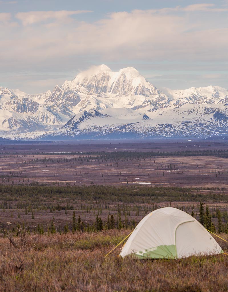
As mentioned above, you can camp along the Denali Highway. There are countless pull-offs along the road where you can camp in an RV or campervan or just set up an old-fashioned tent.
If wanting to stay in a maintained campground you have two options, Tangle Lakes at Milepost 21.5 and Brushkana Creek at Milepost 104.
Denali Highway Lodges
For those that want to leave the camping gear at home, there are five lodges along the Denali Highway as mentioned earlier in this post. Here is a handy list of them along with their mile markers:
- Denali Highway Cabins– Milepost 0.25
- Tangle River Inn– Milepost 20
- Maclaren River Lodge– Milepost 42
- Alpine Creek Lodge– Milepost 68
- Clearwater Mountain Lodge– Milepost 82.2
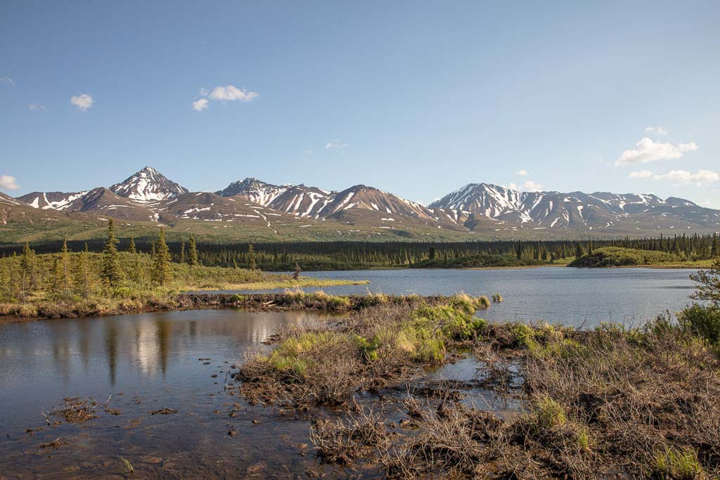
Points of Interest Along the Denali Highway
The Denali Highway is littered with points of interest, scenic viewpoints, and adventure. The following is a comprehensive list of the most well-known and scenic stops along the way. Note that this is written as if you will be traveling from Paxson to Cantwell but know you can do this trip in either direction.
Paxson Junction: Milepost 0
You’ve reached the start of the Denali Highway when you arrive at Paxson, a small town of about 40 people. The abandoned Paxson Roadhouse and Paxson Lake are the two draws of stopping into town.
Paxson Alpine Tours & Denali Highway Cabins: Milepost 0.25
Just a short jaunt from the center of Paxson you’ll find the Denali Highway Cabins for those that reach Paxson at the start (or end) of their Denali Highway road trip that doesn’t want to camp. Nearby you’ll find Paxson Alpine Tours which can arrange trips further afield in this area of Alaska.
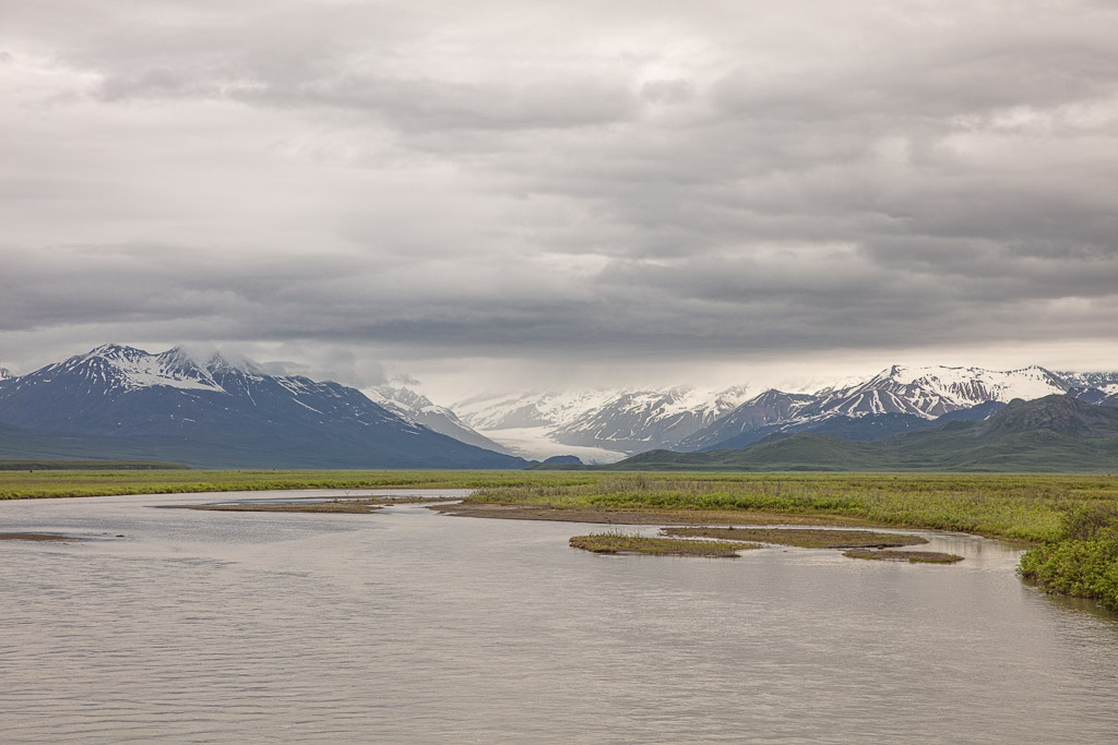
Alaska Range Viewpoint: Milepost 6.5
The Alaska Range Viewpoint is a pull-off with informational signs as well as amazing views of Gakona and Gulkana Glaciers along with epic views of the Alaska Range in the distance.
10 Mile Lake Trail: Milepost 10
Just as the name of this trail suggests, at milepost 10 you’ll reach a trailhead that leads you on a short walk to a lake with great burbot fishing.
Wrangell Viewpoint: Milepost 13
From this viewpoint, you’ll have stunning views back toward the southeast of the Wrangell St. Elias Range’s giants: Mount Drum, Mount Wrangell, and Mount Sanford.
Swede Lakes, Middle Fork Gulkana Branch Trail, Dickey Lake, & Alphabet Hills: Milepost 17
This trailhead at milepost 17 leads to several different places. The closest is Swede Lakes which are only about a 2 mile walk from the start of the trail. Just a short distance beyond Bis Swede Lake will take you onto Dickey Lake.
Back on the Swede Lakes Trail, it’s possible to continue onto the Middle Fork Gulkana Trail which will take you across the Gulkana River and lead you to the Alphabet Hills. Bring rubber boots if you plan to take on this route as the path is quite muddy.
Tangle Lakes Archeological District East Boundary: Milepost 17-38
Between Milepost 17 and 38 along the Denali Highway is the largest concentration of North American Subarctic archeological artifacts. This area near Tangle Lakes has been inhabited by Athabaskans for over 10,000 years.
Tangle River Inn: Milepost 20
Look for the giant sign that says PIZZA! and you’ve arrived at Tangle River Inn. Built in 1953, this homestead turned into rooms and cabins for rent. Like the sign suggests you can get a hot pizza here, but also you can rent a canoe to paddle around Tangle Lakes in.
Pavement Ends: Milepost 21
Wave goodbye to the smooth asphalt for the next 110 miles, the road goes to dirt starting here at milepost 21.
Tangle Lakes Campground: Milepost 21.3
Just beyond the pavement’s end arrive at Tangle Lakes Campground, one of two maintained BLM campgrounds along the Denali Highway. There are 45 camping slots here as well as a boat launch, outhouses, and potable water.
Campsites are on a first-come-first-served basis. Normal campsites are $12/night and walk-in campsites are $6/night.
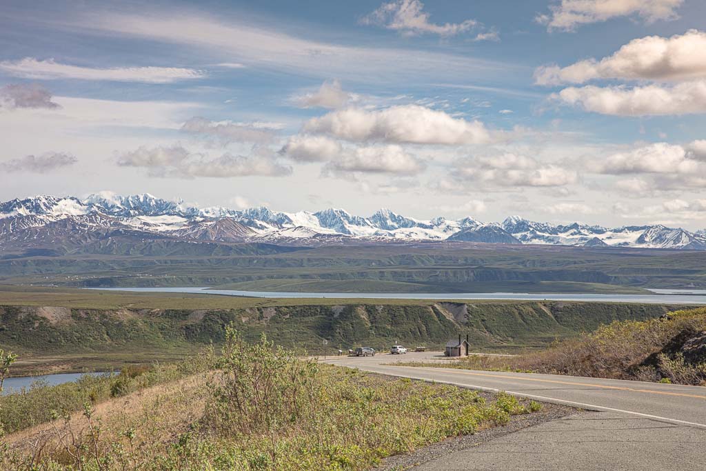
Delta River & Delta National Wild Scenic Wayside: Milepost 21.5
Just beyond the campground, you’ll reach the Delta Wilds Scenic Wayside which has a picnic table area, a boat launch, and outhouses. This is a common drop-in point for canoers heading up to Upper Tangle Lake and for kayakers taking on the Delta River.
Find out more about floating the Delta River and read up more on the Delta Wilds. Note that the Delta Wilds Scenic Wayside is not a campground.
Landmark Gap View: Milepost 22.5
A common migration route for the Nelchina caribou herd, Land Mark Gap is a feature carved out by glaciers past.
North Landmark Gap Trail: Milepost 24.6
Used by hikers, bikers, and ATV riders, the North Landmark Gap Trail takes you about 3 miles off of the Denali Highway and into the Tangle Lakes Archeological District. The path features informational signboards along the way marking sites of significance.
Rock Creek Bridge & South Landmark Gap Trail: Milepost 24.7
Just a hair further will bring you to the South Landmark Gap Trail which gives access to a scenic 5 mile hike to a viewpoint for Tangle Lakes or an 8 mile hike to the southeast to reach Osar Lake (mud boots recommended for the South Landmark Gap Trail!).
Back on the Denali Highway just beyond the trailhead is the one-lane bridge over Rock Creek.
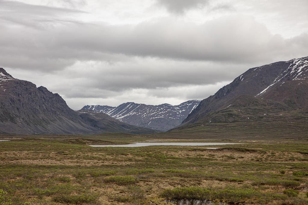
Glacier Lake Trail: Milepost 30
At milepost 30 reach the trailhead for Glacier Lake, a 3.2 mile hike across tundra landscapes.
Maclaren Summit, Maclaren Trail, Osar Lake Trail, & Alaska Range/Maclaren River Viewpoint: Milepost 37
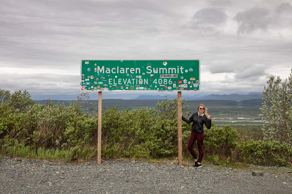
As you make your way up to Maclaren Summit, you’ll pass the main trailhead for Osar Lake, a trail that will take you along eskers in the tundra. Eskers are large ridges of stratified sand and gravel left behind in once glaciated areas.
Atop Maclaren Summit, you’ll be on Alaska’s second highest highway pass at 4,086 feet in elevation. It is signposted and the viewpoint offers sweeping views of the Maclaren River and Alaska Range. From the summit, you will also find the 3 mile out and back Maclaren Trail.
Thermokarsts, Palsas & Kettle Lakes: Milepost 41
Here at milepost 41, you can view the interesting subpolar features of thermokarsts and palsas.
A palsa is a frost-heave found in polar and subpolar regions that contain permafrost ice lenses. An ice lens is a localized accumulation of ice formed when moisture, diffuses within soil or rock.
Thermokarsts are sinkholes formed by the melting of the ice within the palsa’s ice lens in these permafrost systems. Some thermokarsts will eventually fill with water and form lakes, which can be seen here at Kettle Lakes which are technically thermokarsts.
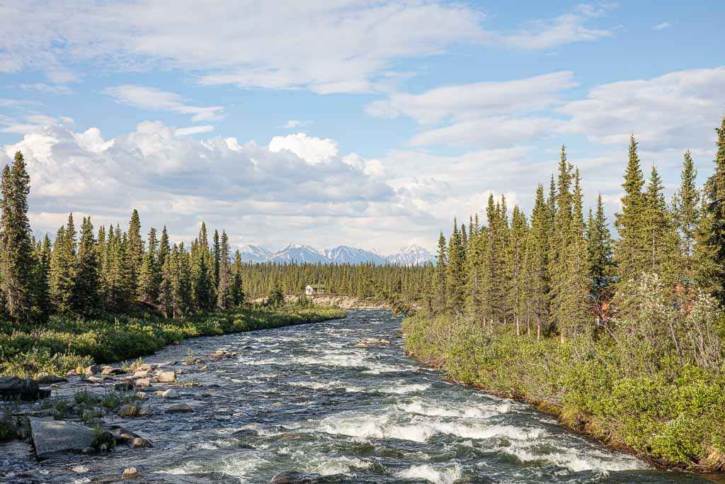
Maclaren River, Maclaren Bridge & Maclaren Lodge: Milepost 42
At milepost 42 of the Denali Highway, cross over the Maclaren River bridge to the other side to reach the Maclaren River Lodge. At the lodge, there is a full-service restaurant serving breakfast, lunch, and dinner, and rents out cabins. The lodge also rents out canoes, can arrange various day trips, and even offers up firewood and tire repair services.
Just beyond the Maclaren River Lodge, you’ll reach a scenic viewpoint pull-off with views of the Maclaren Glacier in the distance.
Maclaren River Trail: Milepost 43
The Maclaren River Trailhead gives access to both Hidden Lake and Maclaren Glacier. Hidden Lake is a 10 mile journey each way, whereas Maclaren River is a 16 mile jaunt.
Crazy Notch: Milepost 46
Crazy Notch is a geological feature that the Denali Highway passes through at milepost 46, carved into the Earth by the Maclaren Glacier long ago leaving high glacial moraines on either side of it. The notch was carved even deeper by a creek that formed.
It’s not uncommon for this area of the Denali Highway to be impassible in late spring and fall due to snow drifts that accumulate here. Just beyond passing through Crazy Notch at milepost 47, you’ll pass Mile Lake just off the side of the road.
Waterfowl Lakes: Milepost 49.5
Home to a variety of waterfowl as the name implies, Waterfowl Lakes are great to post up at if you’re hoping to get in on some birdwatching along the Denali Highway.
Clearwater Creek Wayside: Milepost 55.5
Clearwater Creek Wayside is a great place to camp along the Denali Highway with plenty of parking area and even outhouses.
Eskers: Milepost 59
As the name implies, you’re on an esker here at milepost 59 so make sure and take a look around you. Remember as mentioned earlier in this post, an esker is a ridge of sand and gravel left behind by a glacier that once sat in the area.
Alpine Creek Lodge: Milepost 68
For those driving the Denali Highway without camping gear, the Alpine Creek Lodge is a great option as it sits close to the halfway point along the drive. The lodge features a bar and restaurant and can arrange for various day tours in the area.
Hatchet Lake Road: Milepost 68
Just beyond Alpine Creek Lodge, you will spot the turn-off for Hatchet Lake Road. It is a 4×4 track that leads the 4 miles to Hatchet Lake.
Susitna River Bridge & Valdez Creek Road: Milepost 79

At milepost 79 you will reach another one-lane bridge crossing over the Susitna River. You will also find the turn-off for the Valdez Creek Mine nearby.
Clearwater Mountain Lodge: Milepost 82
Clearwater Mountain Lodge offers up cabin accommodation in addition to a campground. Campsites (for campers and limited RV space) go for $10/night. They also have showers and laundry available for $10 and $5 per load respectively.
Old Valdez Creek Mine: Milepost 85
Active from 1903 to 1995, the Old Valdez Creek Mine is visible to the east of the Denali Highway.
Canyon Creek & Alaska Range Viewpoint: Milepost 95
From here you can explore the Canyon Creek area. There are interpretive signs here in the parking lot detailing information about the Alaska Range that you can see in the distance.
Brushkana Creek Campground: Milepost 104
Brushkana Creek Campground is the second of the BLM-maintained campgrounds along the Denali Highway. There are 22 campsites available here with outhouses, potable water, a picnic area, and interpretive signs.
Campsites are first-come-first-serve and go for $12/night and walk-in sites are $6/night.
Canyon Creek: Milepost 107
Perfect for grayling fishing Canyon Creek is right off the side of the highway here.
Seattle Creek: Milepost 111
Another one-lane bridge along the Denali Highway crosses Seattle Creek, a perfect spot for dolly varden and grayling fishing.
Taiga Forest: Milepost 111.5
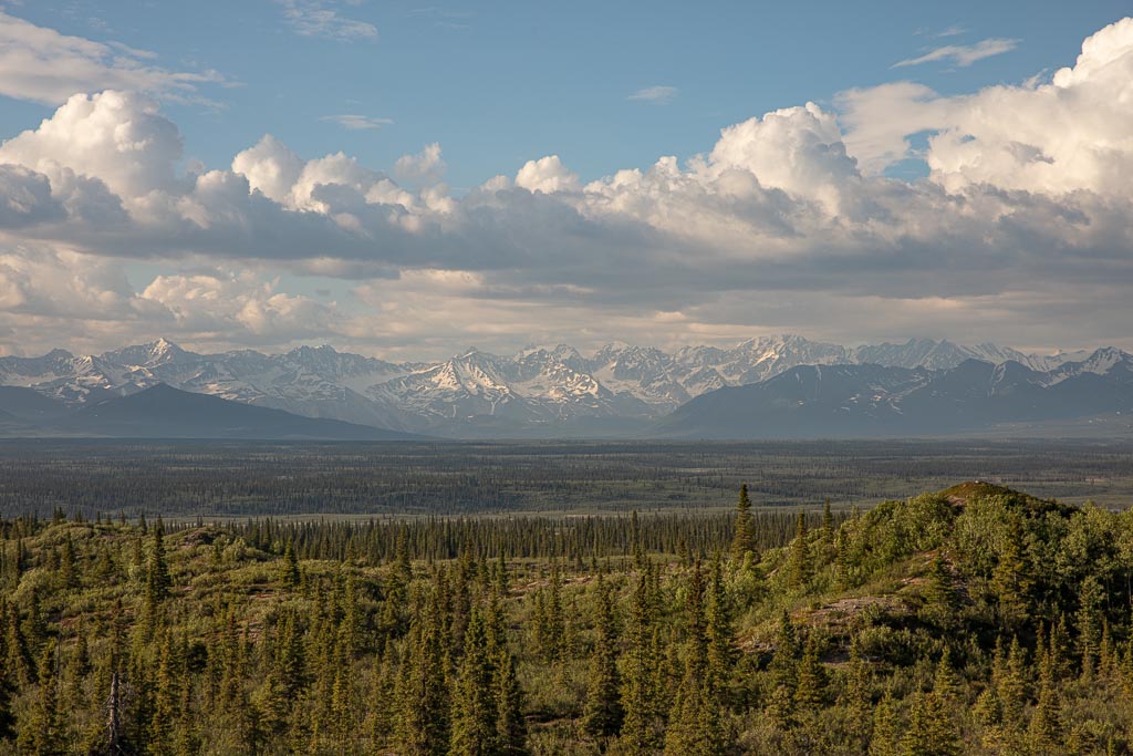
At milepost 111.5 you’ll be somewhat elevated where you’ll have great views of the Boreal taiga forest just off of the Denali Highway.
Nenana River: Milepost 116
Originating from the Nenana Glacier, the Nenana River is visible here from this pull-off at milepost 116.
Denali View: Milepost 124
If you’re lucky and the weather is clear, you should have grand views of North America’s tallest peak of Denali here at milepost 124. There’s another spot at milepost 128 that give great views of the mountain too.
Fish Creek: Milepost 127.5
At Fish Creek, you will find a parking lot from which you can explore the area or try your hand at grayling fishing.
Pavement Begins Again: Milepost 132
Nearing Cantwell, you’ll finally reach pavement once again.
Cantwell Junction: Milepost 134.5
At milepost 134.5 the Denali Highway ends where it meets with the Parks Highway. A short drive along the Parks to the north will bring you up to the entrance for Denali National Park and beyond to Fairbanks. To the south will take you down to Talkeetna and eventually on to Wasilla and then Anchorage.
Your information has been very helpful as we plan our trip! Thank you!